

Date: October 28, 2026
Location: Nishinoshima Island, Oki Islands, Shimane Prefecture, Japan
Executive Overview
For travelers seeking an untouched sanctuary where dramatic geological formations meet rolling pastoral landscapes, the island of Nishinoshima in Shimane Prefecture offers one of the most breathtaking road trips in the Japanese archipelago. Situated within the Oki Islands—a UNESCO Global Geopark—Nishinoshima presents an ever-changing visual canvas of deep blue seas, soaring basalt cliffs, and wide open pastures where cattle and horses graze freely under expansive skies.
While navigation applications often default to narrow, precipitous mountain tracks, experiencing this remote paradise safely requires a carefully planned route. Beginning at Beppu Port, the island’s primary maritime gateway, a self-drive itinerary along National Route 485 and Shimane Prefectural Route 315 leads explorers directly to world-renowned natural landmarks such as Matengai Cliff and Tsūtenkyō Arch.
This report provides an authoritative, step-by-step navigational guide for a scenic rental car journey through Nishinoshima. It details vital route waypoints, essential driving precautions, guidelines for interacting safely with the island’s free-roaming livestock, and logistical insights for securing transportation in an emerging destination defined by its fragile ecological and pastoral balance.
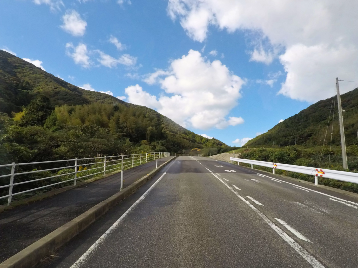
Detailed Chronology: A Step-by-Step Navigational Guide
Embarking on a self-drive expedition across Nishinoshima transforms simple transportation into an immersive exploration of coastal geography. To ensure a seamless journey from arrival to departure, drivers should observe the following chronological itinerary.
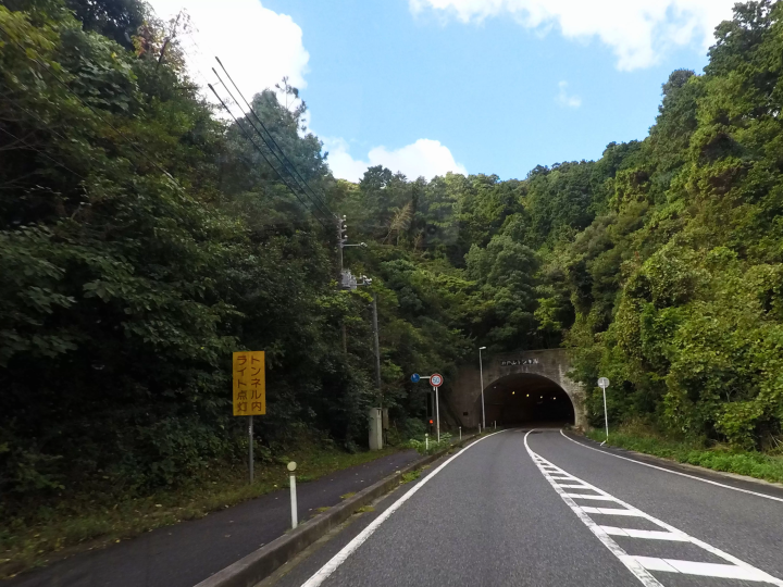
Phase 1: Departure from Beppu Port and the Initial Ascent
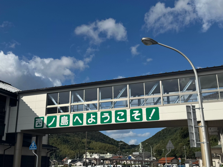
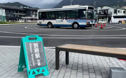
The journey begins immediately upon disembarking from the ferry at Beppu Port, the central transportation hub of Nishinoshima. Travelers who have secured a rental car in advance complete their vehicle inspection and documentation at the port before merging onto National Route 485, heading north and west toward the Kuniga Coast.
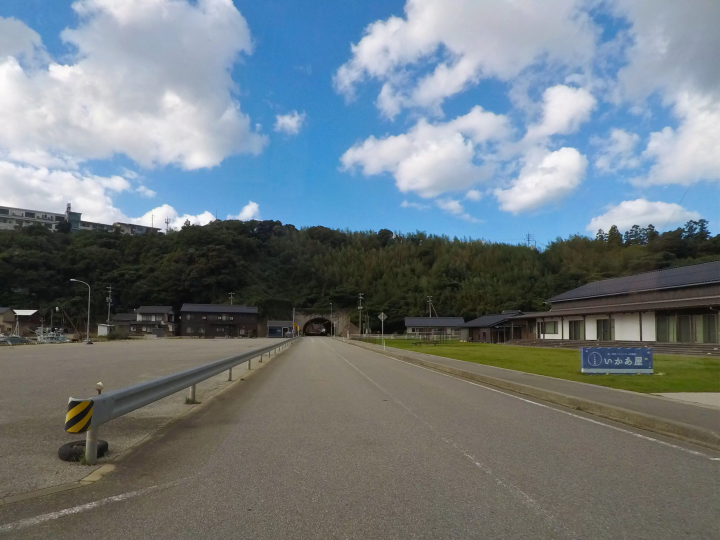
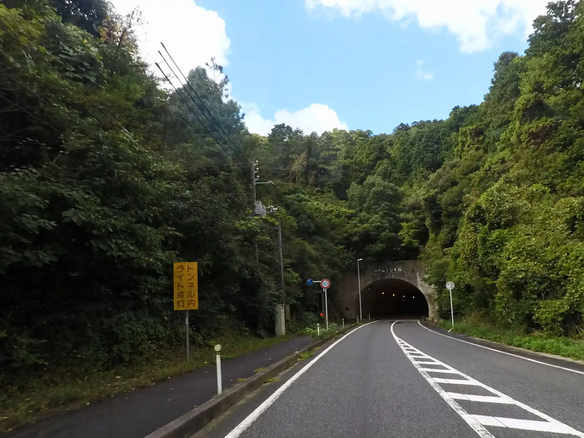
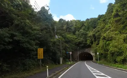
As motorists leave the port infrastructure behind, the topography shifts rapidly. The route guides drivers through a series of three coastal tunnels, including the Hinode Tunnel. Emerging from these subterranean passages offers a dramatic reveal: the landscape abruptly opens, exposing contrasting maritime vistas on either side of the road as the route tracks toward the island’s rugged western shores.
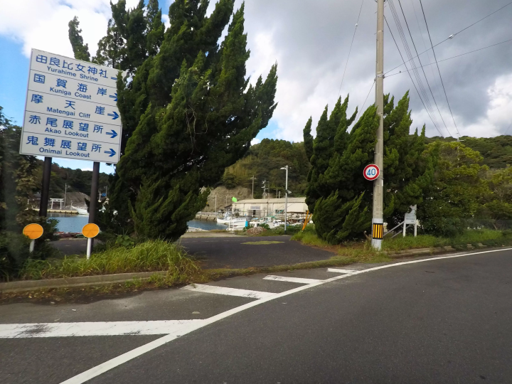
Passing a local bridge and continuing straight, motorists will note the Nishinoshima Community Library on the right along the road toward Uragō. While drivers eager to reach the coastal heights may choose to press onward, this cultural landmark serves as a convenient cultural waypoint for the return leg of the journey.
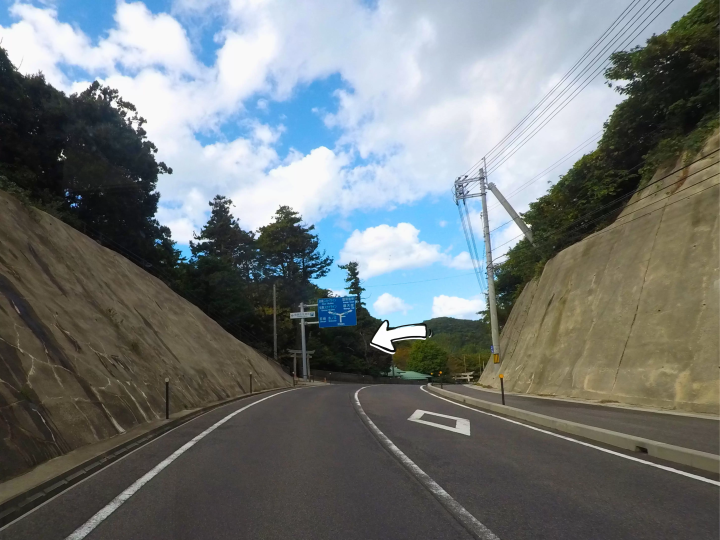
Phase 2: Transitioning to Prefectural Route 315 and Yurahime Shrine
Upon reaching the road running alongside Uragō Port, drivers must transition onto Shimane Prefectural Route 315, officially designated as the Kuniga Coast Line.

- Navigational Advisory: This segment introduces several winding, undulating sections. Drivers must reduce their speed, remain vigilant for oncoming traffic, and adapt to shifting coastal micro-climates and road contours.
- Cultural Interlude: Shortly along this route, Yurahime Shrine appears on the left. Boasting a profound historical lineage, this sanctuary is officially recognized as a myōjin taisha—a shrine of exceptionally high historical and spiritual status—documented in the Engishiki, an ancient 10th-century compilation of Japanese laws and shrine registries. Travelers pressed for time may bypass the shrine to prioritize daylight hours at the Kuniga Coast, exploring the sacred grounds at a more leisurely pace on their return trip.
Phase 3: Navigating the Critical Fork and Entering the Pastoral Zone
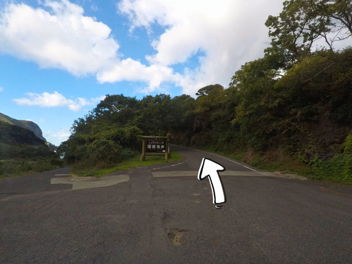
Shortly past Yurahime Shrine, drivers encounter a critical juncture that frequently confounds first-time visitors relying on automated GPS systems:
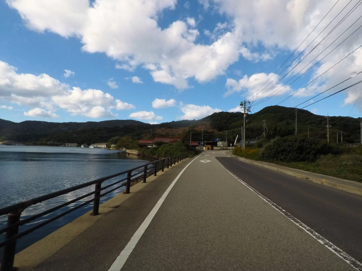
- The Fork in the Road: Drivers must navigate a subtle divergence by following directional signage pointing toward the Kuniga Coast.
- Uphill Ascent: The route climbs steadily via an interior tunnel. Emerging on the opposite side introduces motorists to an entirely different facet of Nishinoshima: vast, sweeping highlands reminiscent of alpine meadows suspended directly above the ocean.
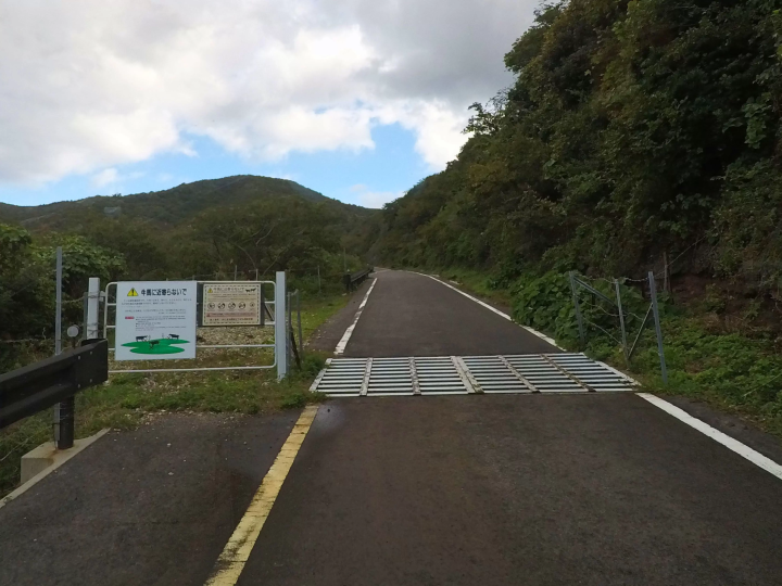
- Livestock Territory Entrance: Passing a local cattle shed marks the official entry into the island’s expansive grazing zones. At this threshold, drivers encounter a Texas gate—a cattle grid embedded in the road surface designed to restrict livestock movement without physical fences. Motorists must reduce speed significantly to cross the grid safely before navigating deeper into the pastures.
Phase 4: Arrival at Matengai Cliff
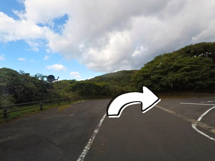
Continuing along the pastoral road, drivers will encounter a brown directional sign marked "Kuniga Coast," followed immediately by a Y-junction:
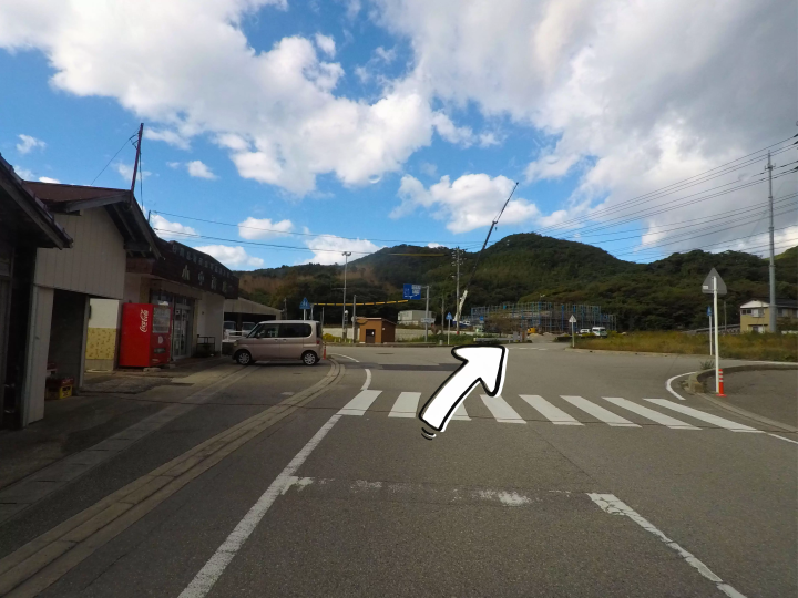
- The Final Turn: Take the right fork at the Y junction, remaining alert for the relatively small sign indicating Matengai Cliff. A subsequent right turn places the vehicle on the final approach road.
- The Summit Car Park: After navigating a final left turn at a T-junction and a brief uphill climb, motorists arrive at the Matengai Cliff car park.
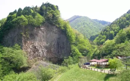
Here, towering 257 meters directly above the Sea of Japan, Matengai Cliff unfolds in breathtaking scale. Visitors leave their vehicles in the designated lot to explore the precipitous walking trails.
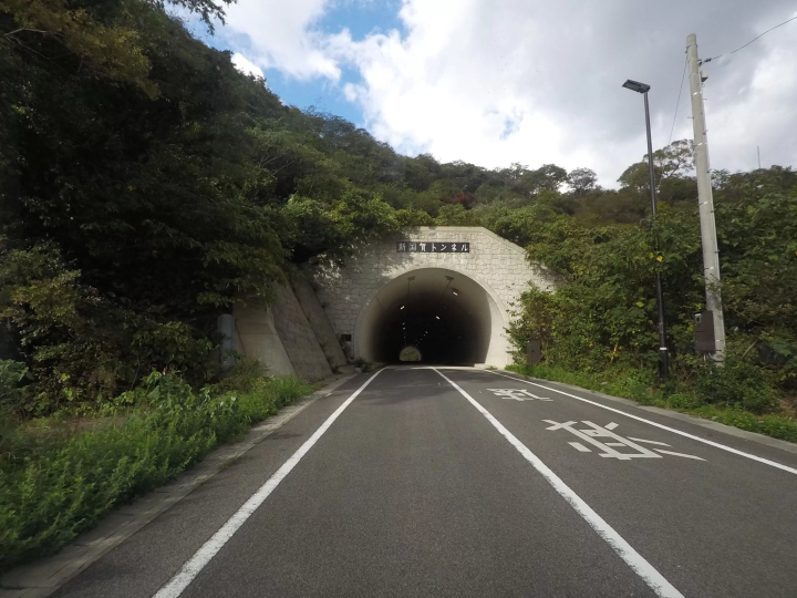
- Critical Operational Rule: The car park is secured by a physical gate designed to prevent free-roaming cattle and horses from entering the lot, protecting both the animals and parked vehicles. All visitors are strictly required to manually close and latch the gate upon every entry and exit.
Phase 5: Proceeding to Tsūtenkyō Arch
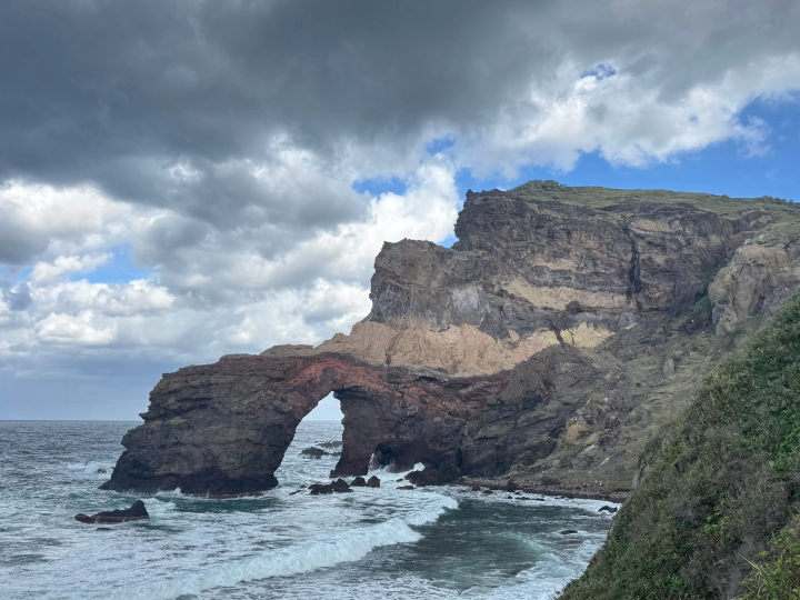
Following the exploration of Matengai Cliff, motorists return to their rental vehicles to execute the final leg of the driving tour toward Tsūtenkyō Arch, a dramatic natural sea arch carved by centuries of relentless wave action.
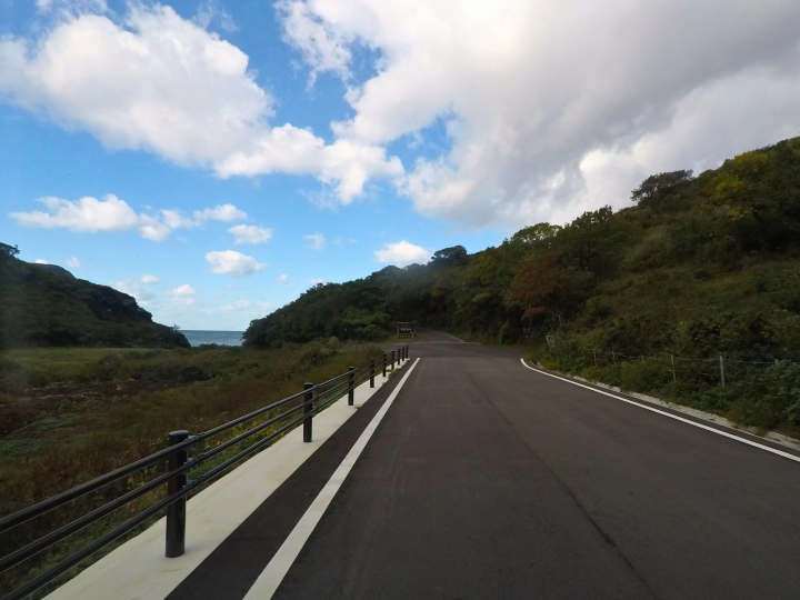
- Retracing the Route: Drivers retrace their path down from the Matengai parking lot, returning through the Texas gate zone to the T-junction.
- The Turnoff: Turning right at the junction leads motorists down a secondary coastal access route.
- The Final Approach: The road terminates at a spacious, designated parking area. Important Note: The final approach path leading directly to Tsūtenkyō Arch is legally closed to ordinary passenger vehicles and reserved exclusively for authorized personnel. Visitors must park in the designated lot and complete the final stretch on foot along the paved walking trail.
Supporting Context & Metrics: Nishinoshima’s Tourism and Industry
Understanding the delicate balance of Nishinoshima requires examining the intersection of tourism management, infrastructure limits, and traditional agricultural practices.
- Geographical Designation: Nishinoshima is one of the inhabited islands comprising the Oki Islands archipelago, recognized globally for its unique geological history, rare endemic flora and fauna, and status as a UNESCO Global Geopark.
- Rental Car Infrastructure: Ground mobility on the island relies almost exclusively on private vehicles or limited local bus networks. There are precisely three licensed rental car providers operating on Nishinoshima. Because of the island’s remote isolation and limited municipal vehicle fleets, inventory is severely constrained. Tourism authorities universally advise booking rental automobiles months in advance concurrently with ferry reservations.
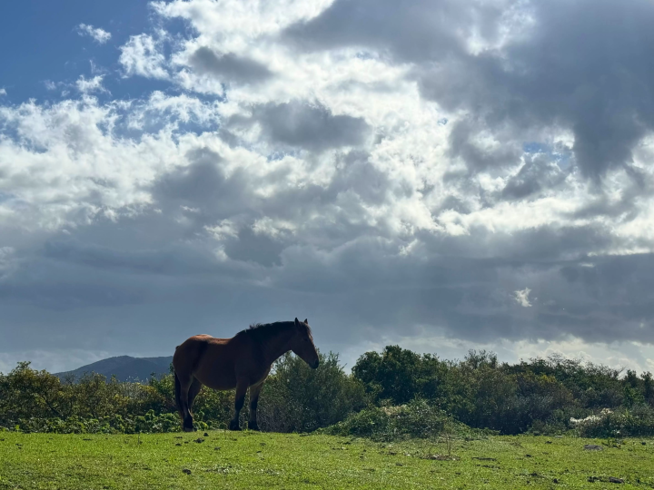
- Agropastoral Economy: Livestock farming represents a cornerstone of Nishinoshima’s traditional primary industry. Cattle and horses are intentionally released into vast municipal and cooperative pastures—including large tracts surrounding the Kuniga Coast—to maintain open pastoral vistas, prevent forest encroachment, and preserve the cultural landscape.
Official Guidelines: Safety Protocols for Free-Roaming Livestock
Unlike domesticated animals in urban petting zoos, the cattle and horses inhabiting Nishinoshima’s coastal cliffs are semi-feral livestock. While managed by local farmers, they roam unrestricted across large swaths of public land and are unaccustomed to close human interaction. To prevent injury to both tourists and animals, local authorities and tourism associations enforce strict behavioral protocols:
- Maintain Distance: Observers must maintain a wide physical buffer zone. Approaching livestock too closely triggers defensive instincts.
- No Physical Contact: Touching, petting, or attempting to halter the cattle and horses is strictly prohibited.
- Zero Feeding: Offering human food, snacks, or foraged vegetation disrupts animal diets and encourages aggressive food-seeking behaviors.
- Beware the Rear: Approaching horses from behind is hazardous; equines possess powerful hind-leg kick reflexes capable of inflicting severe trauma. Always remain within the animal’s direct field of vision.
- Supervise Minors: Parents and guardians must maintain active physical control over children within all grazing areas.
- Vehicular Caution: When livestock occupy or wander near roadways, drivers must bring their vehicles to a complete or near-complete stop, refraining from honking horns or accelerating past the animals abruptly.
Future Outlook
As international and domestic interest in sustainable geotourism accelerates, Nishinoshima faces a delicate operational paradox. The island’s economic vitality relies on welcoming travelers to marvel at destinations like Matengai Cliff and Tsūtenkyō Arch, yet its fragile infrastructure—exemplified by limited rental car availability and narrow coastal roadways—imposes strict carrying capacities.
Moving forward, regional authorities and the Nishinoshima Tourism Association are focusing on visitor education and infrastructure management. Emphasizing low-impact driving habits, adherence to strict livestock safety protocols, and advanced travel planning will be essential to preserving the raw, untamed beauty of the Oki Islands. For the discerning traveler willing to plan meticulously, Nishinoshima offers an increasingly rare commodity: an authentic, unhurried encounter with the raw elemental forces of the Earth, where humanity, livestock, and nature coexist in a dramatic balance at the edge of the sea.





Belum ada komentar. Jadilah yang pertama berkomentar!